I'm not sure anyone cares about this kind of thing, but...
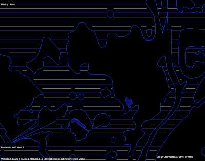
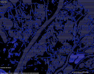
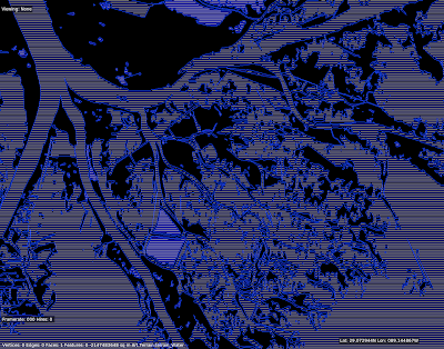
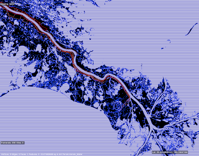
These are pictures of a test of the rasterizer. The rasterizer is code in both the DSF creator* and X-Plane that converts polygons into lines or boxes. What good is that? We use it to:
- Plant trees inside a polygonal forest in a DSF.
- Process all of the elevation points inside a polygonal water body when making a DSF.
Etc., etc. These were from a performance test rasterizing the Mississippi delta at 1201 x 1201; because the vector data is insanely detailed (something like 2 million line segments I think) it's a good test of performance. The blue lines represent a line fit, but the white lines are a "box fit" - that is, they ensure that not only are they "inside" the water, but the area above and below them are too.
* Programming geeks can use this code - it's in PolyRasterUtils.


5 comments:
looks impressive.. thanks for continuing to update everyone on x-plane & it's technologies
Thanks again, Very impressive so far and I think x-plane 10 will be my only sim even thought I invested tons of money in FSX.
Evan.
Hi Ben,
we are a group of developers of the project VFR CR (Czech republic). In recent months we were made quiet close data of the water area coverage. We manually traced most of ponds and rivers with GoogleEarth, and then transferred the data to ESRI SHP. With MeshTool v2 we generated a new basemesh tiles. Everything works perfectly in version 9 …
I was wondering if it would be if it is possible to use this data to generate global scenery for XPL10
It's too late at this point to submit data for v10, and we generally do not take specific data submissions.
If your data does not violate a Google license (and I do not know how tracing fits in) I suggest you add your water bodies to OpenStreetMap, which would allow us to easily use the data in the future.
OK, thanks for quick reply. I have one more question if could be possible generate with meshTool and these our data new basemesh tiles with the new features of version 10?
Post a Comment